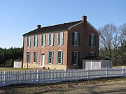
Mississippi Valley Loess Plains (ecoregion)
Level III ecoregion in the United StatesThe North American Mississippi Valley Loess Plains are a Level III ecoregion designated by the Environmental Protection Agency (EPA) in six U.S. states. The region lies primarily on the eastern border of the Mississippi Alluvial Plain, from the Ohio River in western Kentucky, through Tennessee and Mississippi, to Louisiana. A separate unit that includes Crowley's Ridge occurs west of the river in Arkansas and Missouri. It has been divided into four Level IV ecoregions.
Read article
Top Questions
AI generatedMore questions
Nearby Places

Goodman, Mississippi
Town in Mississippi, United States

Holmes County State Park
State park in Mississippi, United States

Mississippi in the American Civil War
Holmes Community College
Community college in Goodman, Mississippi, U.S.

Mississippi
U.S. state

Franklin, Mississippi
Unincorporated community in Mississippi, United States

Richland, Holmes County, Mississippi
Unincorporated community in Mississippi, United States

Eureka Masonic College
United States historic place


